17 Fall Hiking Spots Near St. Louis You Need to Explore
By Riverfront Times Staff on Fri, Oct 27, 2017 at 8:53 pm
The leaves are turning, the temperature is (finally) cooling off, and suddenly, it actually feels like fall in St. Louis. Take advantage of the beautiful colors and autumn breezes by heading out to some of these perfect fall hiking spots near St. Louis. You'll get a workout, beautiful scenery and plenty of Instagram-worthy photos, making these the ideal places to spend a fall day. By Melissa Buelt
Scroll down to view images
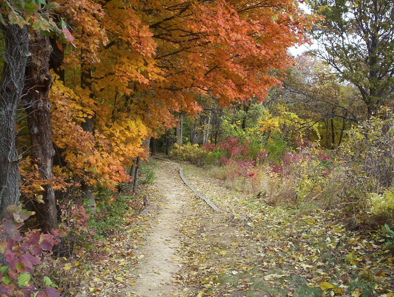
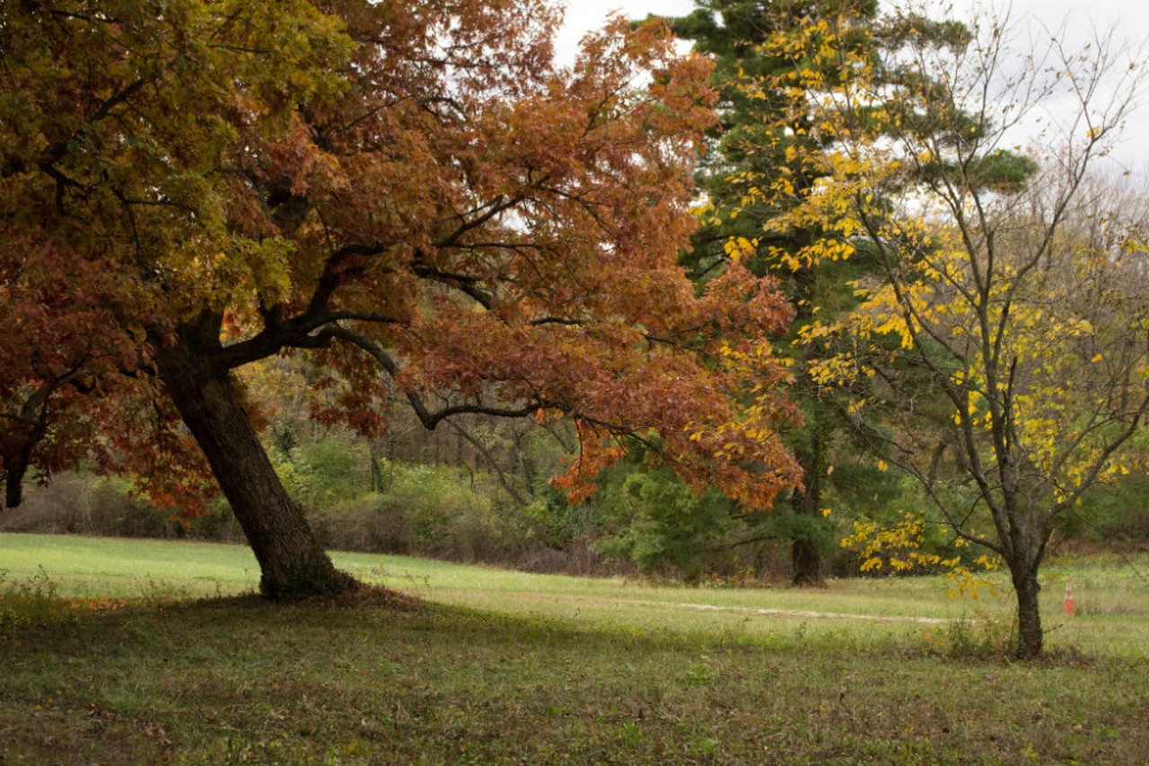
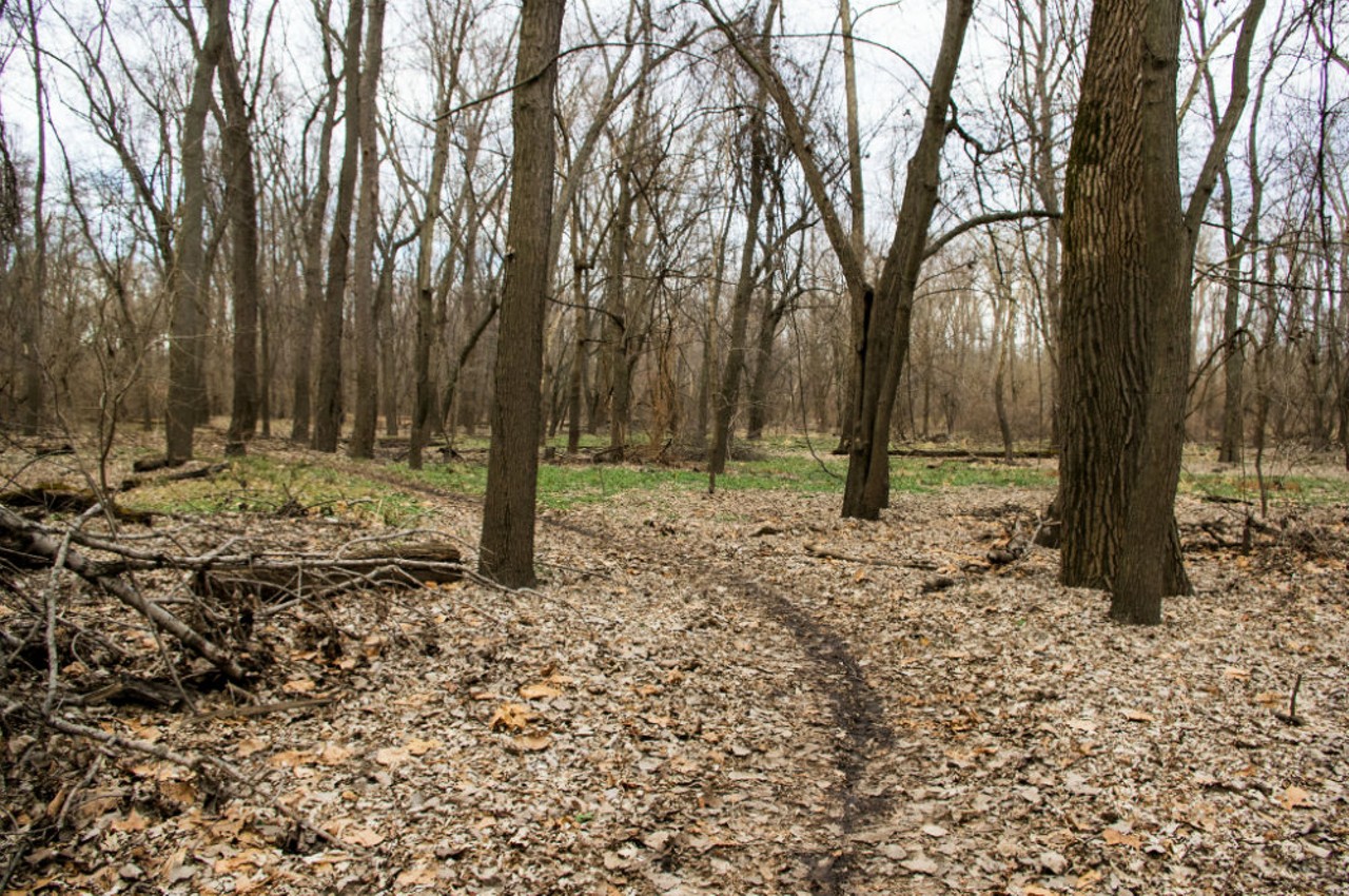
Castlewood State Park
1401 Kiefer Creek Rd.
Ballwin, MO 63021
(636) 227-4433
Explore the broad meadows filled with wildlife or take in the scenic views of the fall foliage at Castlewood State Park. The trails of Castlewood are great for hiking and biking whether you’re a first time rider or one who has more experience on the trails. It’s the perfect place to get away and have an adventure for the day, or reserve a campsite and stay the night. The park is also regarded as one of the best mountain biking locations in the St. Louis area.
Photo courtesy of Flickr | Mona Maynard
1 of 17
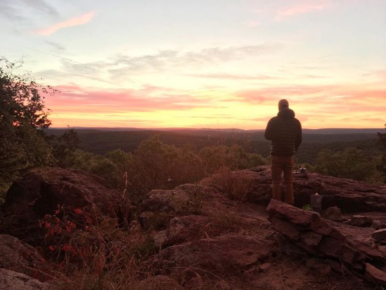
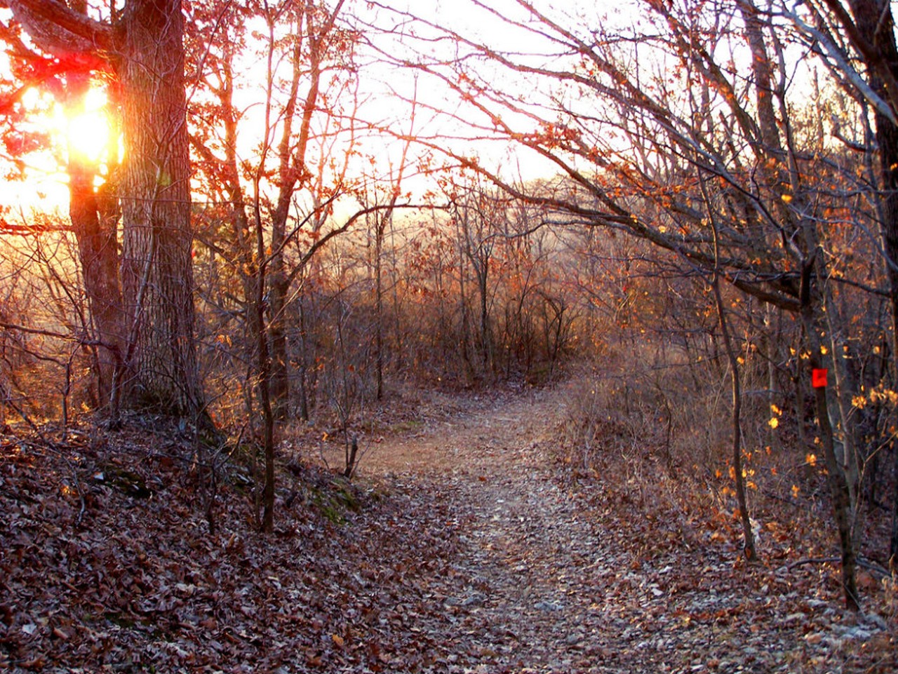
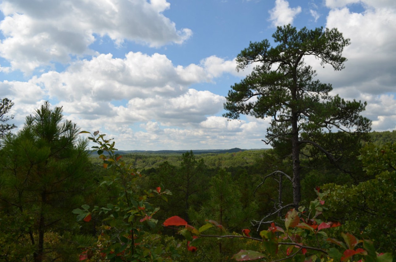
Bell Mountain Wilderness
Belleview, MO 63623
Bell Mountain is a must-see for anyone looking for a daytime adventure or a backpacking excursion. The Bell Mountain Trail is a maintained pathway that crosses the wilderness for about six miles before it joins a section of the Ozark Trail, which runs from St. Louis to the Arkansas border. For more adventurous visitors, the Lindsey Mountain Trail is the second-highest point in the wilderness, climbing almost 2.5 miles one way. Since it is not part of the formal trail system, it is not regularly maintained. But the sunset alone makes the hike well worth it.
Photo courtesy of Instagram | lefthandbecca
2 of 17
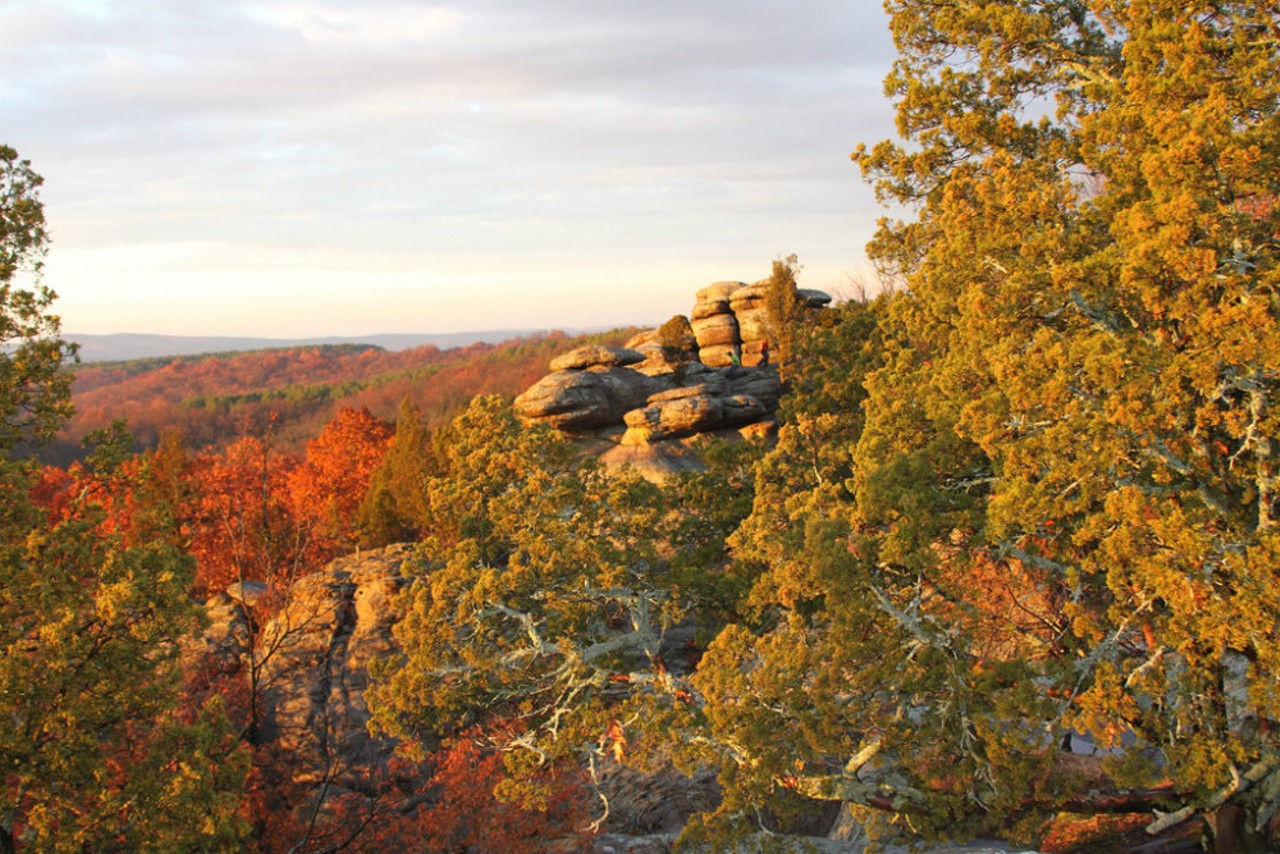
Garden of the Gods
Observation Trail
Herod, IL 62947
Explore one of the most inspiring views of the Midwest. Spanning more than 3,300 acres of forest throughout Southern Illinois, Garden of the Gods features magnificent bluffs that drop more than 100 feet and breathtaking views of the Shawnee National Forest. Adding to the scenic beauty, it is home to a variety of plant and animal life. Warning to trail-goers: rocks along the trail can be slippery and dangerous when wet.
Photo courtesy of Flickr | grover webb
3 of 17
Washington State Park
13041 MO-104
De Soto, MO 63020
(636) 586-5768
Washington State Park has a variety of hiking options, from easy strolls to power hikes. The Rockywood trail is just one of three. This six-mile trail features caves, nice vistas and two-thirds of Missouri’s known petroglyphs. It also features a backpack camp a third of the way along the trail. At the camp, hikers are asked to “leave no trace,” meaning fires are not allowed. Come back when it’s warm and enjoy swimming and fishing with easy access to the Big River.
Photo courtesy of Instagram | dxestlmo
4 of 17
Pere Marquette State Park
13112 Visitor Center Ln.
Grafton, IL 62037
(618) 786-3323
Pere Marquette State Park is one of the most picturesque in Illinois, spanning 8,000 acres of beauty. The best time to visit is in the fall when the leaves are changing. Take a scenic drive through the park and discover just how stunning the season can be, or hike the trails that flow through the hills.
Photo courtesy of Flickr | Eric Bueneman
5 of 17
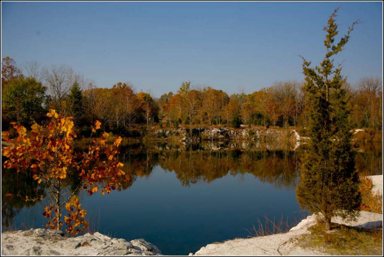
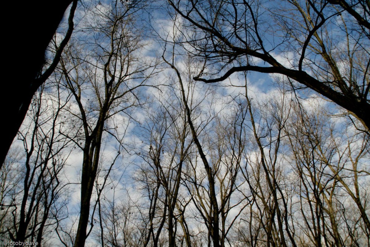
Klondike Park
4600 Highway 94 S.
Augusta, MO 63332
636-949-7535
Covering 250 acres, Klondike Park offers both natural and paved trails for you to explore, as well as a white sand beach. Klondike Park was previously the site of an old silica sand quarry and is now preserved into a parkland. Nestled in Missouri’s wine country, this park has become a prefered camping destination to spend a weekend in one of the rustic cabins.
Photo courtesy of Flickr | Dave Clark
6 of 17
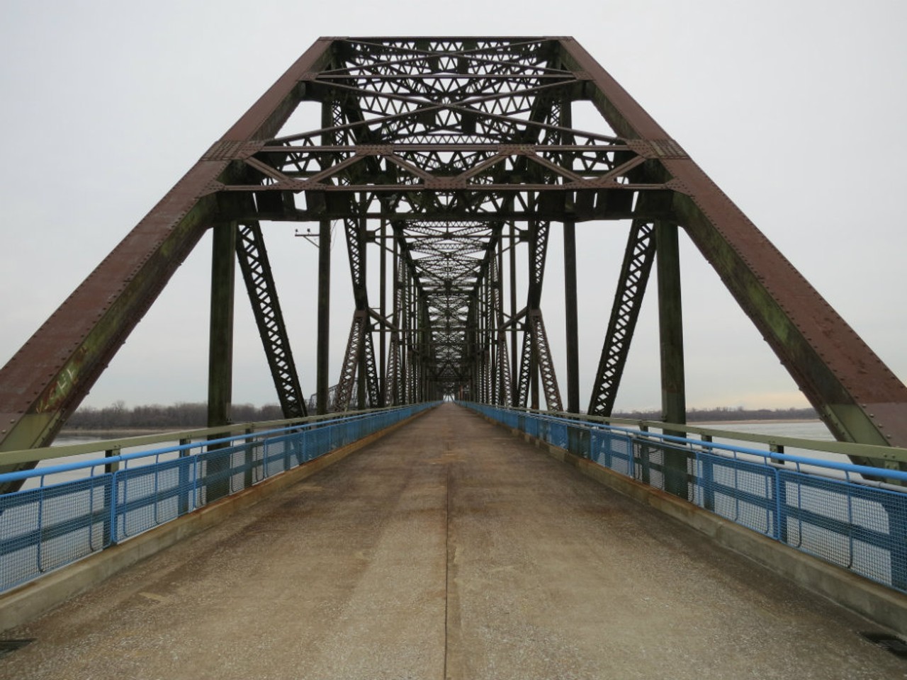
Chain of Rocks Bridge
Madison, Illinois to St. Louis, Missouri
Chain of Rocks Bridge has been a significant landmark for travelers along Route 66 for three decades. Officially listed in the National Register of Historic Places in 2006, the bridge is connected to more than 300 miles of trails on both sides of the water. The beautiful views of the Mississippi and the free parking on the Illinois side are an added perk.
Photo courtesy of Flickr | Paul Sableman
7 of 17
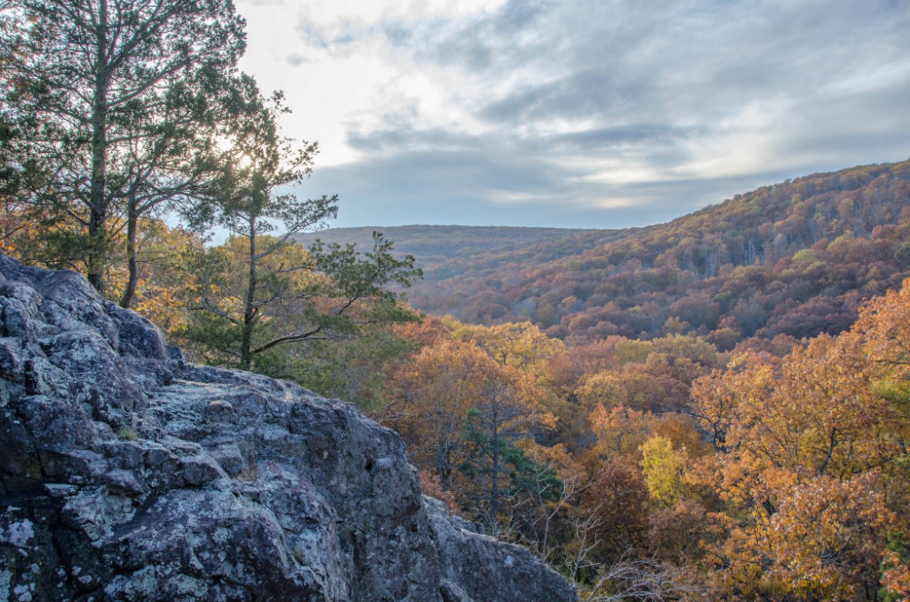
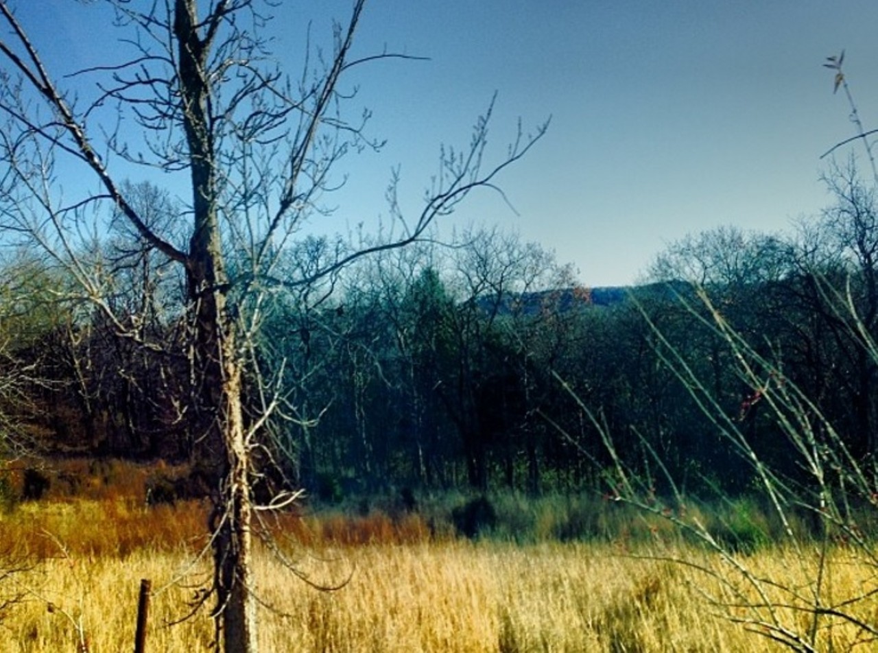
Mina Sauk Falls Trail at Taum Sauk Mountain State Park
Hwy. CC
Ironton, MO 63656
(573) 546-2450
At 1,772 feet, Taum Sauk Mountain is the highest point in Missouri, making Mina Sauk Falls the tallest waterfall in Missouri. The Mina Sauk Falls Trail is a three-mile loop offering great overlooks where you can get a picturesque view of the St. Francois Mountains. This trail is considered moderately difficult, so prepare yourself for a rugged, rocky climb.
Photo courtesy of Flickr | Keith Yahl
8 of 17
Hawn State Park
12096 Park Dr.
Ste. Genevieve, MO 63670
(573) 883-3603
Spanning 4,956 acres in western Ste. Genevieve County, Hawn State Park offers a beautiful scenic landscape and unique experiences for those who want to enjoy the brilliance of nature. The Overlook trail is good for first-time visitors, who can explore a short, paved trail leading to an overlook with views of the pine and oak-covered hills of Pickle Creek valley.
Photo courtesy of Flickr | Missouri Division of Tourism
9 of 17
Dr. Edmund A. Babler Memorial State Park
800 Guy Park Dr.
Wildwood, MO 63005
(636) 458-3813
Dr. Edmund A. Babler Memorial State Park features hiking, biking and an equestrian trail with varying distance and difficulty levels. The Dogwood Trail rises and falls several times over the maximum altitude of 300 feet, which allows you to see the vast array of forest habitats found within the park. The park also offers a paved bike trail, for those who want to get some exercise without overdoing it.
Photo courtesy of Instagram | lmbkw06
10 of 17
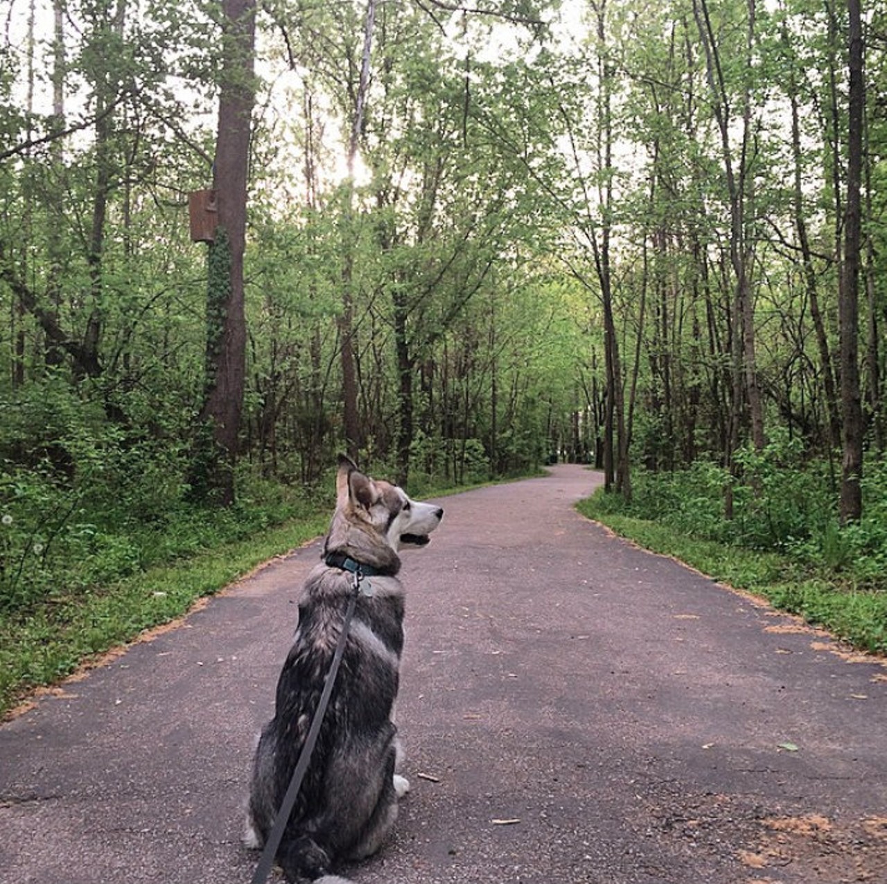
August A. Busch Memorial Conservation Area
2360 Hwy D
St Charles, MO 63304
(636) 441-4554
Spanning 3,000 acres of forest, grassland, prairie, cropland, fields and wetlands, this conservation area offers a variety of popular activities. Walk the trails, photograph the wildlife or choose a spot under a tree and enjoy the sights and sound of nature.
Photo courtesy of Instagram | anantha_nv
11 of 17
Minnie Ha Ha Park
801 Old Gravois Rd.
St. Louis, MO 63127
(314) 842-7265
Part of the Meramec Greenway, the 23 acres of Minnie Ha Ha Park features a pavilion overlooking the Meramec River, an array of paved walking trails and picnic shelters you can reserve. Have the kids with you? Minnie Ha Ha Park has them covered, too, with three play areas available. In the early 20th century, the beach at Minnie Ha Ha was also a popular swimming destination.
Photo courtesy of Instagram | dexter_n_dakota
12 of 17
Shaw Nature Reserve
307 Pinetum Loop Rd.
Gray Summit, MO 63039
(636) 451-3512
Owned by the Missouri Botanical Garden, Shaw Nature Reserve makes up 14 miles of hiking trails and is home to an array of plant and animal life. Visitors can choose a short stroll or a several mile hike in various skill levels.
Photo courtesy of Flickr | Jim Rhodes
13 of 17
Fort Belle Fontaine Park
13002 Bellefontaine Rd.
St. Louis, MO 63138
(314) 615-8800
Add a little history lesson to your hike and explore what Fort Belle Fontaine Park has to offer. Established in 1805, Fort Belle Fontaine Park was the first United States military installation west of the Mississippi River. Throughout the year, the park hosts a variety of activities including ghost stories, hayrides, geocaching events and the very popular Eagle Watch and Trail Walk.
Photo by Kelly Glueck.
14 of 17
Greensfelder County Park
4515 Hencken Rd.
Pacific, MO 63069
(636) 458-3801
Located in the foothills of the Ozark mountains, Greensfelder County Park offers trails and fantastic views. For those who like a good challenge (but not too challenging), the park features a 3.5-mile loop trail that is considered moderately difficult.
Photo courtesy of Instagram | flopsita
15 of 17
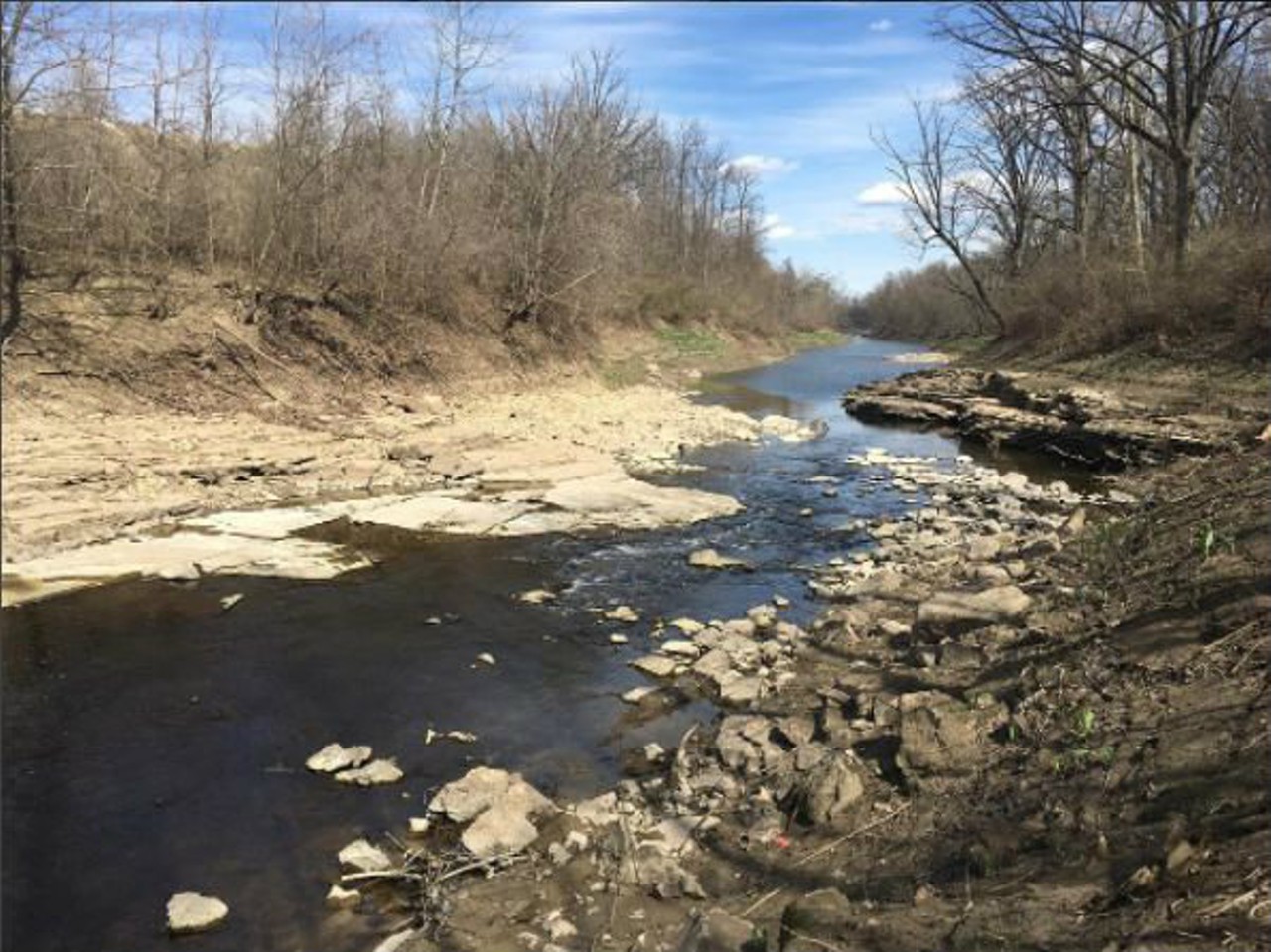
Cliff Cave County Park
806 Cliff Cave Rd.
St. Louis, MO 63129
(314) 615-4386
Cliff Cave Park offers trails for a variety of skill levels, and in some areas, the trails are actually pretty flat. Cliff Cave is the second largest cave in the county and was developed in Mississippian St. Louis limestone. The cave itself is home to a population of Indiana bats, and was closed off in 2009 by St. Louis County Parks to protect the endangered species.
Photo courtesy of Flickr | Dave Clark
16 of 17
Bangert Island
1704 S River Rd.
St Charles, MO 63303
Bangert Island, located in Creve Coeur Park, is the perfect way to explore nature by bike, with easy access right off the Katy Trail. The park covers 160 acres between the Katy Trail and the Missouri River and features several small loops for varying difficulty. The main loop is a figure eight and has a minimal elevation change for beginner riders. The Sandy Loop offers a change of pace that weaves in and out of the drainage troughs alongside the rivers edge.
Photo courtesy of Flickr | miknx
17 of 17


- Local St. Louis
- News
- Things to Do
- Arts & Culture
- Food & Drink
- Music
- Movies
- St. Louis in Pictures
- About Riverfront Times
- About Us
- Advertise
- Contact Us
- Jobs
- Big Lou Holdings, LLC
- Cincinnati CityBeat
- Louisville Leo Weekly
- Detroit Metro Times
- St. Louis Riverfront Times
- Sauce Magazine
All material © 2024 Riverfront Times, St. Louis, MO. All rights reserved.